Mapping, Sharing, and Exporting GPS Data
Last updated: 15 Feb 2022
Your project may include a one or more GPS questions in its form. KoboToolbox will include the GPS data (latitude, longitude, altitude, precision) in the dataset that can be downloaded as XLS or CSV. It is also possible to view the GPS coordinates on an online map and to download the points as a KML file for use in other applications.
Viewing your GPS points
Both of the following options only appear if your form has any GPS questions and has submissions with GPS coordinates.
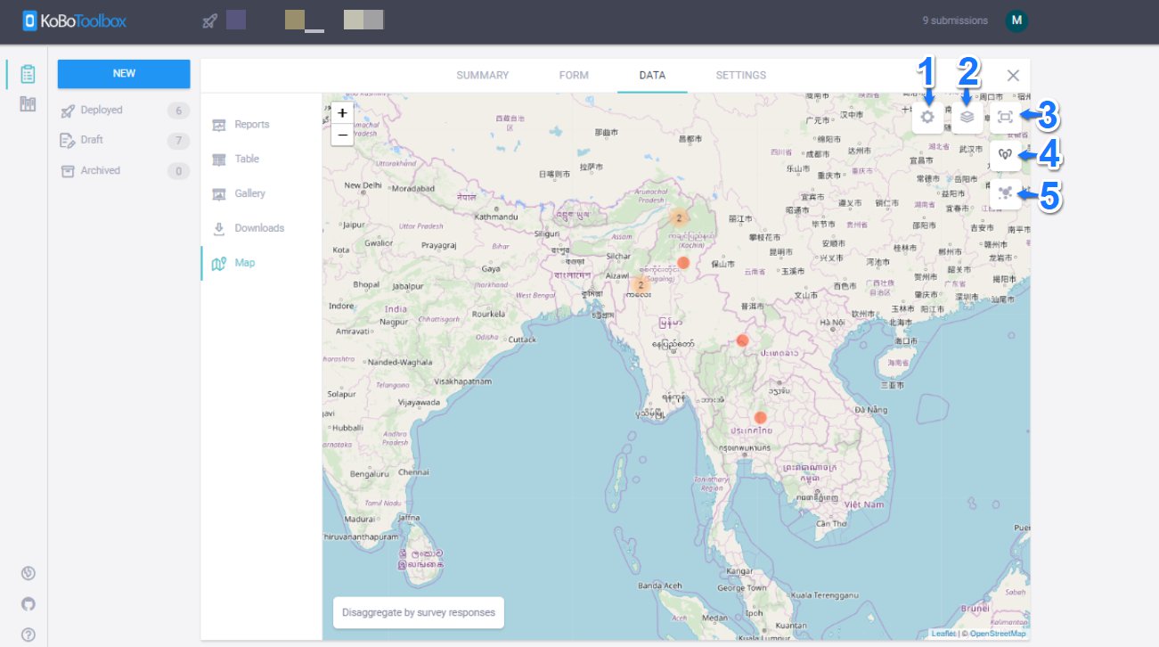
Option 1 - View GPS points online.
Click on the button View on Map, which leads to the online map view. This visualization also allows to see the submissions based on certain question responses. When viewing your data on a map, you can also disaggregate by question responses, such as displaying male and female respondents, or other types of responses where a simple geographic distribution might be interesting. A full list of current map features are below:
-
Settings: Upload data overlays and choose marker color schemes.
-
Toggle layers: Toggle through multiple map background options.
-
Toggle fullscreen
-
Show data as points (default)
-
Show data as heat map
Option 2 - Download GPS points as KML.
Click on the button Download GPS Points. This will start a new export process with the latest data. Previous exports will be listed by their creation date, allowing you do see snapshots of GPS coordinates at various points in time. KML files can be imported in a variety of software, including Google Earth, Google Maps, or professional GIS software, such as ArcMap.
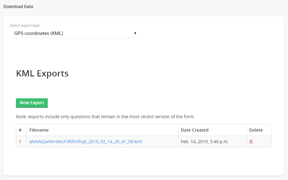
Note: In case your form uses more than one GPS question, only the first one will be used on the map.
Option 3 - Export data as CSV and upload to GIS software.
As an alternative to exporting your GPS data as a KML file, its possible and easy to export and upload your data as a CSV file (which will include all attributes) directly into GIS software as a shapefile. For a step-by-step guide, refer to this help article.
How to share map data
You can share a map with others is to go into your Project’s Settings and enable Share Data. This means that anyone can view your data - i.e. in map, table, or file download format. They won’t be able to edit anything, which would require giving Can Edit permissions to a particular user. After this you can send the URL of the map (see above).
If you have still issues exporting your data, please don’t hesitate to let us know in the Novo Ticket (elengeafrika.com).